With the goal of helping growers and farm managers to be better consumers of remote sensing data, UC Davis researcher Mallika Nocco supplied information about this technology and how it can be applied in tree nut orchards during the virtual Statewide Pistachio Day.
Remote sensing is the process of detecting and monitoring the physical characteristics of an area by measuring its reflected and emitted radiation at a distance, usually from an aircraft, drone or satellite. The imagery was available 20 years ago, Nocco said, but there was no way to manage the information.
Precision irrigation is an agricultural practice where irrigators optimize the spatiotemporal application of water to maximize yield and minimize environmental impacts as well as reduce water use by up to 50% compared to traditional irrigation systems.
“Precision irrigation is becoming technologically feasible,” Nocco said. “But we need scientifically based decision support in an actionable time frame.”
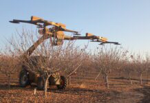
For precision irrigation monitoring and management, Nocco, who is a UCCE specialist in soil-plant-water relations, said there is spatial scale to be considered. For tree rows or blocks, tools include Lysimeters or UAVs which can be used for ET measuring and monitoring. For much larger areas, aerial/proximal sensing can be used to optimize irrigation, and for controlled deficits, deferred irrigation or rotation strategies. Basin or statewide use of remote sensing can be done by satellite for managed groundwater recharge, groundwater banking, policy measures and public-private partnerships.
Understanding what remote sensing can do to promote plant health and productivity is the first step in using the information.
Nocco said that remote sensing tools help estimate ET and identify water stress, but thermal imagery can be much more precise. Multiband imagery is useful for understanding phenology stages, chlorophyll status, which can indicate nitrogen stress, and canopy development.
Nocco noted that the technology is five to ten years from in-season actionable ET mapping with drones. One method does not or will not do it all; concerted research efforts are needed to build information systems.
In her work at UC Davis, Nocco forms partnerships with growers, agencies, stakeholders and other scientists with a vision of precise, integrated decision support for agricultural soil and water management. Using a combination of ground-based sensors and satellites with high-resolution remote and proximal sensing, identification of “hot spots” within a field can be made.

Cecilia Parsons
Cecilia Parsons has lived in the Central Valley community of Ducor since 1976, covering agriculture for numerous agricultural publications over the years. She has found and nurtured many wonderful and helpful contacts in the ag community, including the UCCE advisors, allowing for news coverage that focuses on the basics of food production.
She is always on the search for new ag topics that can help growers and processors in the San Joaquin Valley improve their bottom line.
In her free time, Cecilia rides her horse, Holly in ranch versatility shows and raises registered Shetland sheep which she exhibits at county and state fairs during the summer.


