Most experts agree that using satellites to monitor groundwater is the future for California agriculture. Satellite measurements are accurate enough to determine water usage of a given crop, which has led Groundwater Sustainability Agencies (GSAs) to look at this as a way to monitor groundwater.
Satellite monitoring of crop water use for groundwater management is the wave of the future, according to Joel Kimmelshue, Ph.D., principal agricultural scientist for Land IQ, and it is a method that the regulatory agencies are using.
Tracking of evapotranspiration (ET) through infrared technology for mapping has been around for quite some time, but satellites would actually use regional snapshots of an area or a simple vegetative index, then come up with calculations based on the amount of water a given crop needs.
Mike Wade, executive director for the California Farm Water Coalition, said, “I think between these satellites that are able to measure groundwater and others that measure crop evapotranspiration through infrared spectrometer photography, what I have heard is the experts believe they will be able to accurately monitor groundwater use without metering every pump.”
Water Monitoring Research
Dan Howes, a professor at the Irrigation Training and Research Center (ITRC) at California Polytechnic State University, San Luis Obispo, has been doing research on using satellites to assess plant water use for quite some time.
“There’s been work on assessing plant water consumption, evapotranspiration, using remote sensing, specifically satellites, since I’d say the late 1990s, early 2000s,” Howes said, adding Landsat has been the primary remote sensing data tool.
Landsat 8 is an American Earth observation satellite that launched in February 2013 and is the eighth satellite in the Landsat program. Currently, Landsat 8 has 11 bands of data that can be used for different purposes, including monitoring for plant water use. The ITRC uses a surface energy balance
process based on data from Landsat and ground-based weather data to compute actual evapotranspiration. There are other methodologies also being used for this type of analysis.
The research was originally intended as water management for irrigation districts or water agencies to answer questions like, “I know how much water I’m bringing in, I have meters on that, and I know how much water flows out of the downstream end, but what’s going on with the plants? How much do the plants actually need, and how is that matching with how much I’m bringing in?” Howes said.
“Since the 1940s and 50s, we’ve been trying to do that in different methods, and this was just another leap forward in our traditional assessment of plant water use for design, for management, and then, yes, for farmers, too, for irrigation scheduling. You do have to realize that what we provide, and what we all try to provide for, especially for this groundwater monitoring, is the actual ET (as opposed to the potential ET),” Howes said.
Howes and others are currently in the implementation stage. Satellite data is already being used in several capacities from water analysis to water rights, Howes said.
“We started this whole program of using remote sensing to assess evapotranspiration for groundwater monitoring, for groundwater regulation through the Sustainable Groundwater Management Act (SGMA). And then companies obviously took off from there, and so now, as they take over, we go into more of an expert oversight role,” Howes said, “where we’ll act as the unbiased expert that is called out to make an assessment when needed.”
Ground Truthing
Kimmelshue said Land IQ provides information on how much water has evapotranspired, or how much water the crops use, not what water is applied. “The fundamental mechanism that we use is critical. It is what we call heavy ground truthing which anchors/calibrates our modeling efforts to actual ground measurements of ET for the most accurate estimates of crop water use possible,” he said.
Ground truthing and the collection of ground truth data enables calibration of remote-sensing data and aids in a more accurate and defensible interpretation and analysis of what is being sensed.
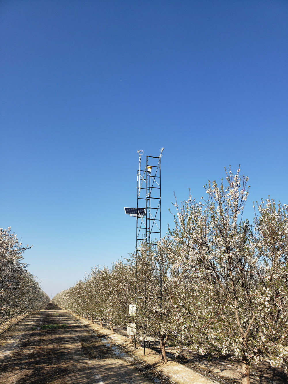
Land IQ has over 100 climatic stations in the southern San Joaquin Valley that measure the parameters necessary to calculate actual ET, then satellite imagery is used to extrapolate the ground truthing measurements across the rest of the landscape, Kimmelshue explained.
“When you’re using remote sensing and looking across an entire landscape, to have data points on the ground that tie you or anchor you to the ground is really valuable, because rather than kind of guessing what it is, you’re measuring what it is,” Kimmelshue said.
What Land IQ provides is more of a water management tool, Kimmelshue continued. “Think about a grower wanting to irrigate a whole season, and the grower only has a certain amount of water that they can pump, an allocation in other words,” Kimmelshue said. “They can use these results to track how they’re doing throughout an irrigation season and determine if they are above or below their allocation.”
Land IQ works for grower representative organizations, water irrigation districts, GSAs and various commodity groups that in turn share this information with their growers.
Advanced Technology
In the Coachella Valley, an avocado grower is experimenting with a pressure sensor that measures the water pressure of the tree. Working with the university and understanding plant physiology, research has found that when the pressure in the tree reaches a certain level, the tree needs water, and it’s irrigated, Wade said.
This grower is taking that to the next level, Wade continued. He’s working to develop an irrigation management system that takes the information directly from the probe so that the tree can essentially determine when to irrigate itself.
The theory is, with the right mechanics and electronics, when the sensor reaches a certain level, it can trigger the irrigation system to turn on, then irrigate to the point where the pressure of the tree reaches the sustainable level, then turn off. In essence, the tree can decide when and how much water it needs based on its own demand.
“If it’s hotter, maybe it’s going to irrigate more often. If it’s not hot, it senses that and it won’t irrigate,” Wade said.
“That’s just one of the other new technologies that are out there that could develop into something that is almost hands-off in terms of meeting crop water needs,” he continued, adding that this technology could possibly transfer into almonds, walnuts and pistachios.
Groundwater Monitoring
What does satellite monitoring of groundwater mean for farmers? “Well, I think what it’ll do is it will make the Sustainable Groundwater Management Act more accurate,” Wade said, “and SGMA needed some methodology to accurately measure groundwater extraction and satellites can do that.”
How this will be translated into regulatory oversight at the local level isn’t known yet, Wade continued. “But I think on the positive side, that means we will be able to meet the needs of the groundwater management act, hopefully on time, over the next 20 years.
“With the right tools, if they (GSAs) can see that block is using more water than the region should be using, and I’m sure there will be a buffer, but if it’s considerably more, then they’re going to be able to tell that you’re probably pumping more groundwater than what the sustainable yield is,” Wade said.
“The vast majority of the industry wants to do a good job, and farmers are remarkable people as a whole. If they’re given a goal, this is what we need to achieve, they’ll figure out how to do it. And I think most farmers want to do the right thing, and they’re going to work toward achieving that,” Wade said, adding that with farmers achieving this on their own, it means less regulation down the road.


