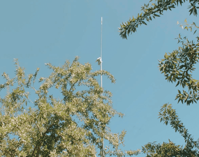
Data overload? Or a deep sense that your knowledge about the conditions of your orchard is confirmed by remote sensing technology?
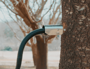
Remote sensing in agriculture is the process of acquiring information about agronomic factors at a specific point, or an area, from a distance. This is typically achieved via an array of different types of in-field sensors but can also be sensed via technologies located outside of the crop itself such as satellites, or sensors that are monitoring infrastructure such as a pump for an irrigation system. The data collected by these remote sensors are generally transferred to a centralized database through either wireless communication with a cloud database or direct collection where you would download the information from a data logger attached to the sensor itself. Once the data has been physically retrieved or pulled from a cloud database, it can be arranged in ways that provide informative representations of, and insights on, the agronomic factors you were sensing. This information and insights can then be used to support in making more data-informed management decisions.
Remote sensing can offer many potential benefits for growers or advisors. When leveraged appropriately, remote sensing can provide more economical ways to regularly sample many key agronomic factors. Think of the capability of being able to access pest counts via a camera-enabled wireless trap on your phone or being able to immediately check in on the current water status of a block while trying to plan an irrigation schedule.
Along with efficient and consistent access to information, data accumulates and becomes a repository of situations, decisions and outcomes which can be incorporated in conversations between farm managers and crop advisors.
Data Correlates to the Ground
Josh Barton of Barton Orchards in Stanislaus County is a believer in the advantages of remote sensing to manage irrigation in his orchards. Simply put, he said remote sensing “provides evidence for optimal inputs.”
Most farmers know their ground, the way water works, the good places and the bad places, Barton said, but they have no specific data that correlates directly to the ground.
The UC Davis Conservation Irrigation Lab reports the future of soil and water management is real-time, fine-scale monitoring using a combination of ground-based sensors, meteorological networks and remote sensing. The lab works in high-resolution sensing of crop water use, soil properties and abiotic stress partnering with growers, agencies and stakeholders with an eye on precise, integrated decision support for agricultural soil and water management. By complementing ground-based sensors and satellites with high-resolution remote and proximal sensing, ‘hot spots’ can be identified within a field and assessed for crop suitability under precision management.
Barton said improved accuracy with remote sensing makes it a valuable tool. 12 years ago, technology was not there for distinguishing different soils, he said. Now, he said it can be relied upon instead of soil probes. Barton said he started using remote sensing with soil moisture monitoring and has progressed to other uses.
One of the advantages of remote sensing is it provides a data resource. “You can go back and generate benchmarks,” he said, noting water use efficiency can be improved because with the data provided you can see when you get it right.
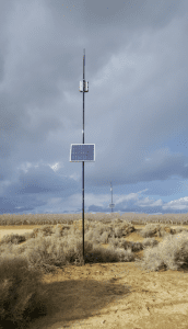
Jordan Hazell, research manager at the agriculture platform Semios, believes remote sensing can serve growers on several fronts. There are notable economic benefits in obtaining information via remote sensing as opposed to requiring dedicated and cadenced trips to perform manual activities to update an understanding of a set of field conditions such as soil moisture status or pest pressure. When data isn’t readily accessible, decision-making may be delayed to update the understandings of field conditions, or stale information could be leveraged as it is the best context available at the time. Both avenues can come at a potential economic cost to the grower.
As remotely sensed data is compiled, it is stored in a manner that can be historically accessible. This can be very important when past decisions and outcomes are being discussed. When crop inputs are being discussed, Hazell said individuals within a management team do not always have the same memory of certain conditions in past growing seasons.
“After a season, it can be very difficult to recall exactly what happened and why, what caused problems during the growing season or the specifics related to why a specific decision was the best one at a given point in time,” Hazell said. With the historical information provided by remote sensing data, they can know exactly what happened out in the field.
In agreeance with Barton, Hazell also believes remotely sensed data can also be collated in a manner to provide a stable ‘measuring stick.’ The compilation of past events and outcomes can support the development of procedures or threshold for action that are agreed upon by growers and their advisors based on their unique goals and priorities.
“It can consolidate their understanding of a certain condition and align on an appropriate action to address those conditions in the future.”
Tribal Knowledge
Hazell also points out that one more often underrated value provided by building datasets of remotely sensed conditions is that it safeguards organizations from developing reliance on ‘tribal knowledge’ about orchard and environmental conditions that occurred in the past. A grower who is handing down their farm after 30 years of farming can find it difficult to impart 30 years of experience and knowledge to those inheriting the responsibility. The same goes with experiential learnings of advisors. When your trusted advisor retires, how can you help enable the next advisor to familiarize themselves with your farm prior to being in the moment? Historical data generated by remote sensing makes historical knowledge and experiential learning more indexable and accessible for those that require it to ensure the most successful crop.
Hazell said there are a lot of different motivations for adoption of remote sensing technology beyond the drive to be sounder in decision-making. One of the drivers, he said, is with more regulations aimed at water and nutrient use on farms, there is a higher level of oversight and reporting overhead. Information on water use and fertilization gleaned from remote sensing can be packaged for the grower or advisor to support more effective and efficient reporting to these regulating agencies with the data they require.
If leveraging remote sensing resonates with your management team, but the managing and maintain of the hardware concerns you, Semios offers Precision Agriculture As A Service (PAAS)TM which allows you to focus on the incorporation of the data into your decision-making by removing the servicing requirements related to the available sensors you want to implement.
Even with PAAS TM, it is important to familiarize yourself with the data and understand there are nuances to interpreting and leveraging remotely sensed data. There are many situations in which sensed information can help detect and inform priority around the need for more manual and technical field pursuits, and therefore should be seen as a key tool in the decision-making process, not a silver bullet.

Cecilia Parsons | Associate Editor
Cecilia Parsons has lived in the Central Valley community of Ducor since 1976, covering agriculture for numerous agricultural publications over the years. She has found and nurtured many wonderful and helpful contacts in the ag community, including the UCCE advisors, allowing for news coverage that focuses on the basics of food production.
She is always on the search for new ag topics that can help growers and processors in the San Joaquin Valley improve their bottom line.
In her free time, Cecilia rides her horse, Holly in ranch versatility shows and raises registered Shetland sheep which she exhibits at county and state fairs during the summer.


