What do drones or UAVs, unmanned aerial vehicles, hold for the future for agriculture? Currently, there are three main uses for UAVs in nut orchards.
1. Multispectral imaging sensors that are mounted to the drone. In the past, the sensors were much larger and they had to be on a manned aircraft, then flown over an orchard. It was very expensive and could only be done a few times a year, but now there are compact sensors and growers can pilot the drones themselves. They can scan their orchards as frequently as they want for a fraction of the cost. And with the ability to scan the crop more frequently, they can evaluate crop health, and make better, more informed decisions.
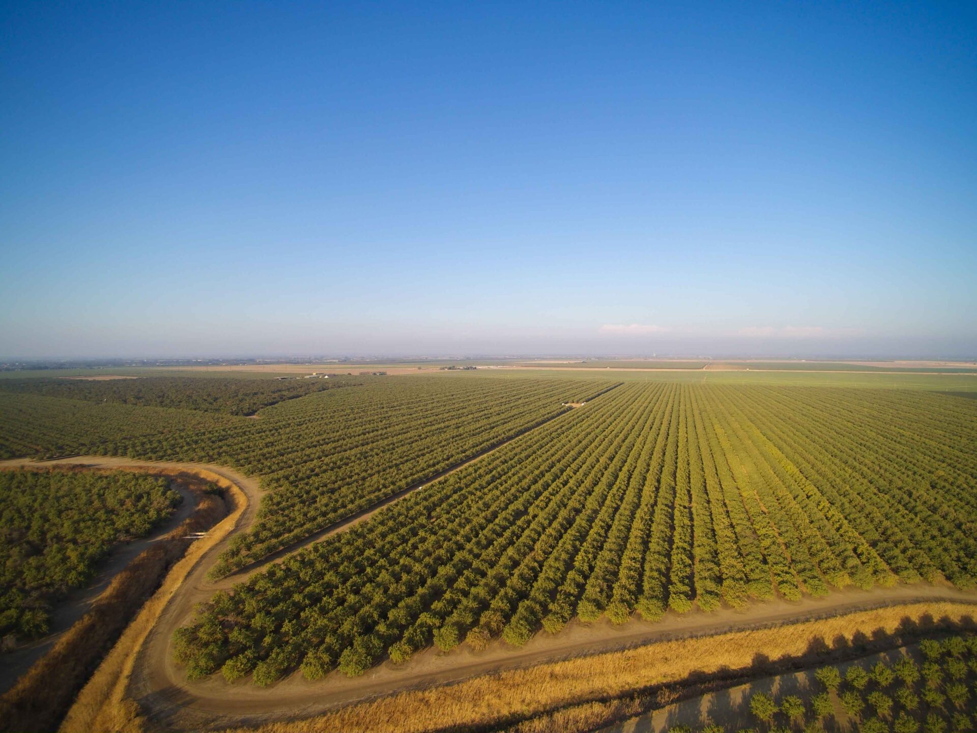
2. Drones can create detailed GPS maps of an orchard using on-board cameras. From these images, orthomosaic maps can be created. Orthomosaic maps are smaller pictures that are stitched together to create one large picture. This gives growers a new perspective of their orchard and allows them to better maximize land, water, and fertilizer usage.
3. Heavy lift drones can carry large quantities of liquid giving them the ability to spray orchards with pesticides. UAV crop dusters are a fraction of the cost of manned aircraft and can be deployed autonomously.
UAV Research
David Doll, University of California Cooperative Extension (UCCE) farm advisor for Merced County has been doing research on UAVs.
“We were working with essentially droned aerial systems or autonomous aerial systems, and we were trying to determine the ability to use these to monitor water stress within trees, particularly nut trees, and more specifically almond trees,” Doll said.
The project had five main objectives, but it really boiled down to determining different imaging techniques or strategies to identify water stress within the trees using low-cost imaging systems, Doll said.
This really means we’re excluding the use of a thermal imaging cameras because of the price, Doll said, which runs anywhere from $10,000-20,000 dollars.
From there, researchers worked on data processing as well as developing a strategy to collect data from orchards that may not have reliable cell service, Doll said.
These different segments of the project were divvied up among multiple researchers that included collaborators from California State University (CSU) Fresno and the University of California (UC) Merced as well as within the Agricultural and Natural Resources (ANR), Doll said.
CSU Fresno
Gregory Kriehn at CSU Fresno, developed sensors that could be programmed to wake up as the drone as it comes into proximity on the sensor, Doll said.
“It would be a real low power use data sensor that can collect a wide variety of whatever you’re looking to collect,” Doll said.
That could be soil moisture or air, but Kriehn developed this relay system where the drone flies into a perimeter, it pings, wakes up the data logger and begins to transmit the data to the drone, Doll explained.
“There are a variety of sensors that may be deployed in the field,” Doll said, adding they collect the data, then the drone would serve as the data collection.If there is an area that has a poor cell phone signal so that the networks can’t be relied on, that would provide the data uploading needed, Doll said.
Low Cost Imaging
Another aspect of the project was low cost imaging. “In that case, what we were looking to do again was try to find a way to develop or modify our vegetation index that we could use to determine water stress,” Doll said.“Most people are familiar with NDVI, which is a vegetation index that gives you an idea of canopy or just essentially how much vegetation is covering a piece of ground,” Doll said.
But what Doll and his colleagues, as well as others have found is, NDVI does not correlate well with plant stress when dealing with perennial crops or three dimensional trees, and in particular, it doesn’t correlate well with almonds.
“That’s simply due to by the time almonds show a change in in canopy due to stress, you’re past the point where you want those trees to be. You want to catch that stress period earlier before it hits that point,” Doll explained. Researchers found that by modifying NDVI to certain formats, to certain locations of the tree, they were able to get a better estimation of plant water stress, Doll said. These were the two big objectives of the research, Doll said.
Research Status
“We’re testing the imaging platform that has been developed,” Doll said, adding the imaging and the data logger apparatus is actually in patent, and Dr. Kriehn is working on wrapping that up. They are also evaluating other tree crops like walnuts as well as the vegetable crops this year, Doll said.
Currently, UAVs are still very expensive, and that is why Doll and his colleagues are searching for a lower cost imager that would help reduce the investment cost to growers.
Interest in UAVs
“I definitely think there’s interest in the (UAV) technology. I don’t know how many growers are into it more than a hobbying component, but our field day almost doubled in size from last year, so I do think there’s people interested in the technology,” Doll said, adding UAVs are still a little bit on the leading edge, and that’s why we’re trying to get it applicable to trees crops.
“I think it does a good job of doing aerial imagery…But the flip end is, the data processing can be a bit cumbersome,” Doll said. “You also don’t have the full toolbox that you’ll see if you’re pulling satellite images,” Doll said.
Other potential uses for drones that are being marketed are aerial releases of natural enemies for pest control, crop pollination, and chemical applications.
There are drones that are large enough to do chemical applications, but they aren’t to the level of crop dusters by any means, Doll said.
“But in issues with tight terrain or steep terrain, and high-value crops, there are certain (UAV) systems that are able to make aerial applications,” Doll said.
Learning Curve
What it comes down to is a drone may be applicable for certain growers, and for others, it’s not, Doll said. “It is expensive to utilize these tools. I mean it may not be expensive to buy them (drones), but to take and process images takes time, and time has value,” Doll said. Getting a drone up and running is much easier. Where it gets challenging is learning to how to properly and effectively stitch images together—the data processing, Doll said.
“The challenges really start coming along when you’re trying to manage the data. You have to be familiar with different types of programs, with overlap, and stitching, and you’ve got to have the computer hardware to do all that,” Doll said, and they’re big files—huge, huge files. “I think the image processing is still the bottleneck,” Doll said.
“There’s a learning curve on both ends, but steeper on the processing of the data,” Doll said.


